
Get New Perspective
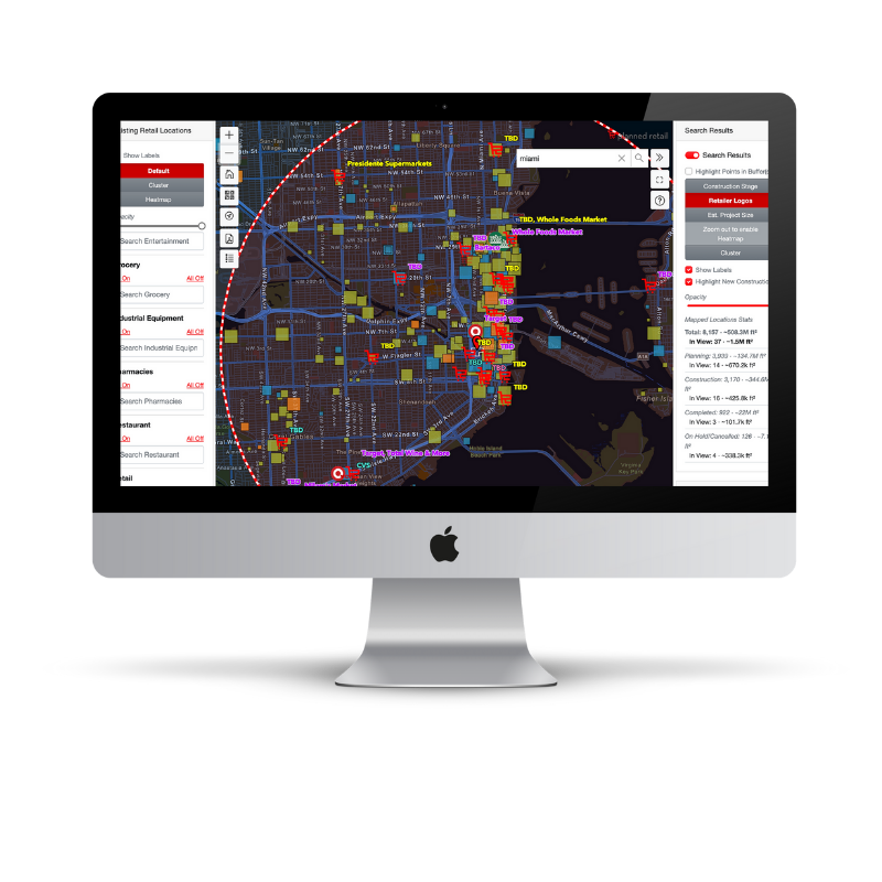
GEOSPEX™ is our planned construction visualization tool, which allows users to assess markets and project opportunities both from 30,000 feet and in granular detail.
Map planned, existing, and completed developments; assess project pipelines; track competition with nearby projects, companies, and brands; and analyze opportunity with geographic, political, demographic mapping overlays.

Get the most out of GEOSPEX
Visualize planned construction activity and assess individual projects, relevant markets, and new opportunities with unique perspective.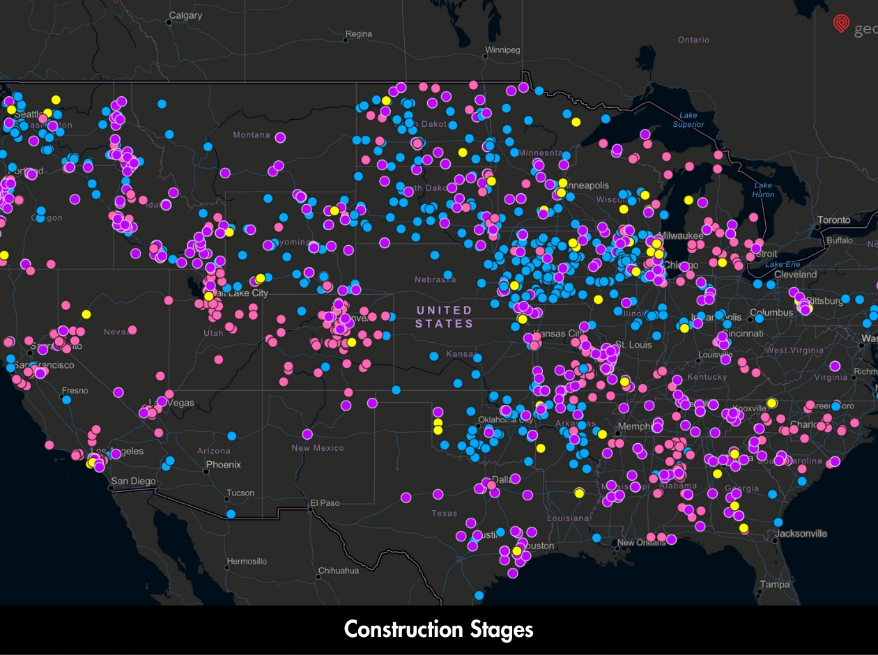
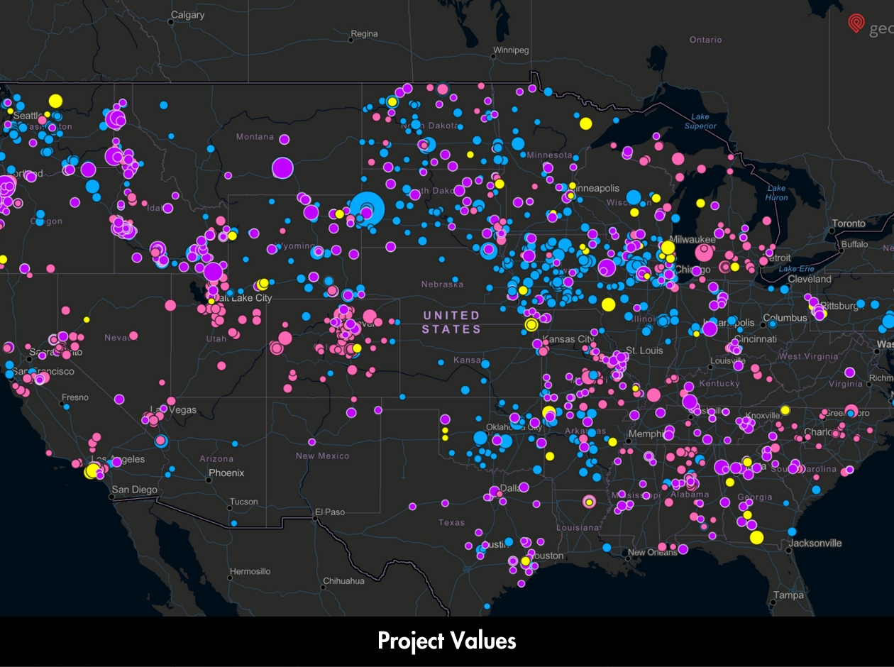
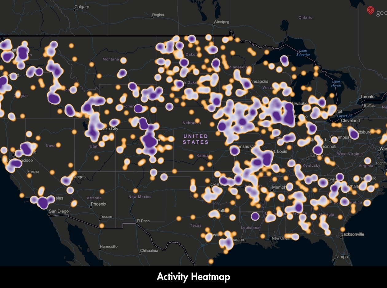
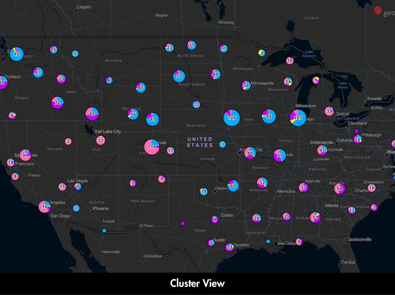
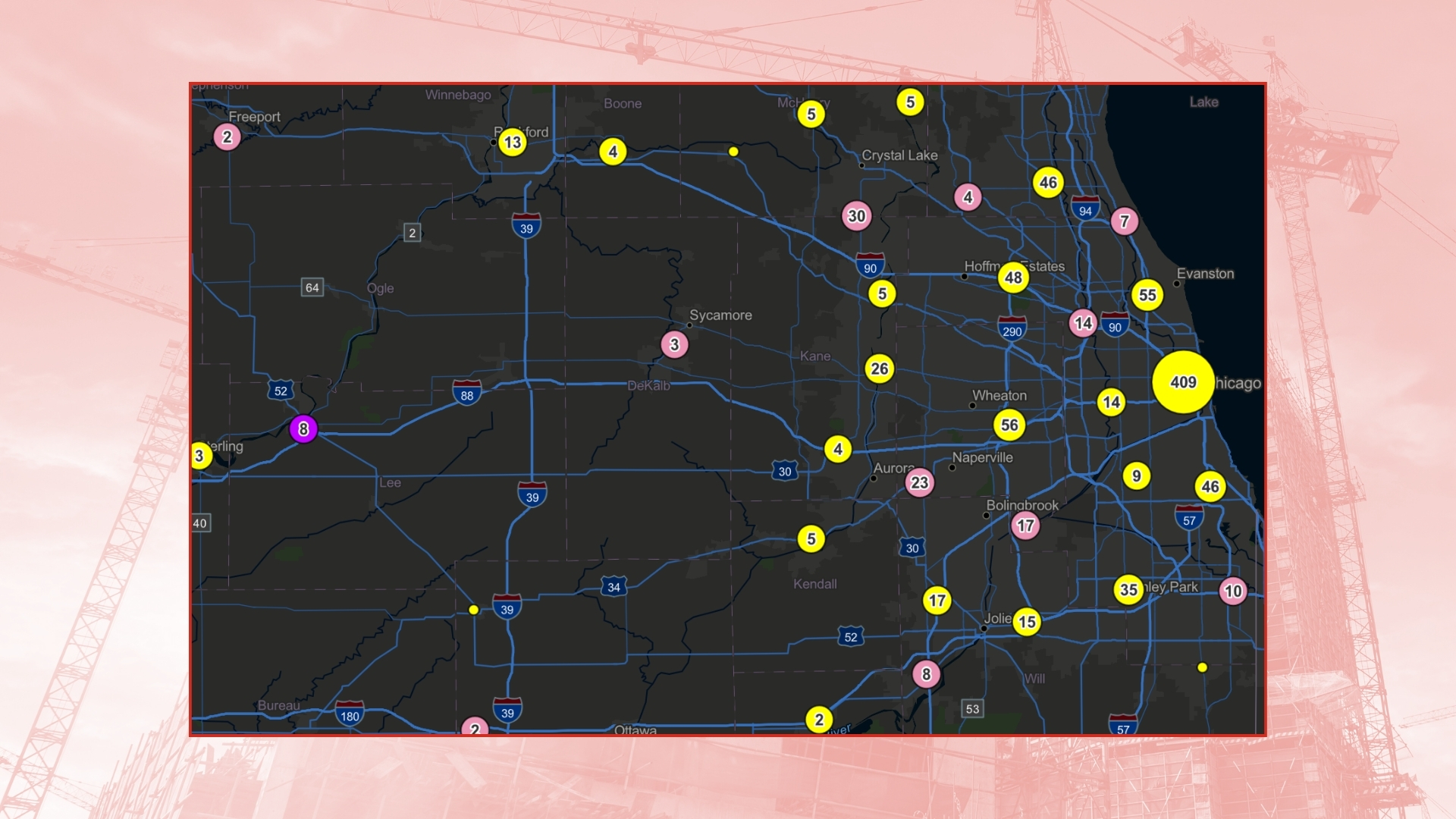
Planned & Existing Projects
Map and analyze construction data for planned, existing, and recently completed developments that impact your projects of interest.
Mapping Layers
Overlay political and geographic boundaries to identify locales that match your requirements.
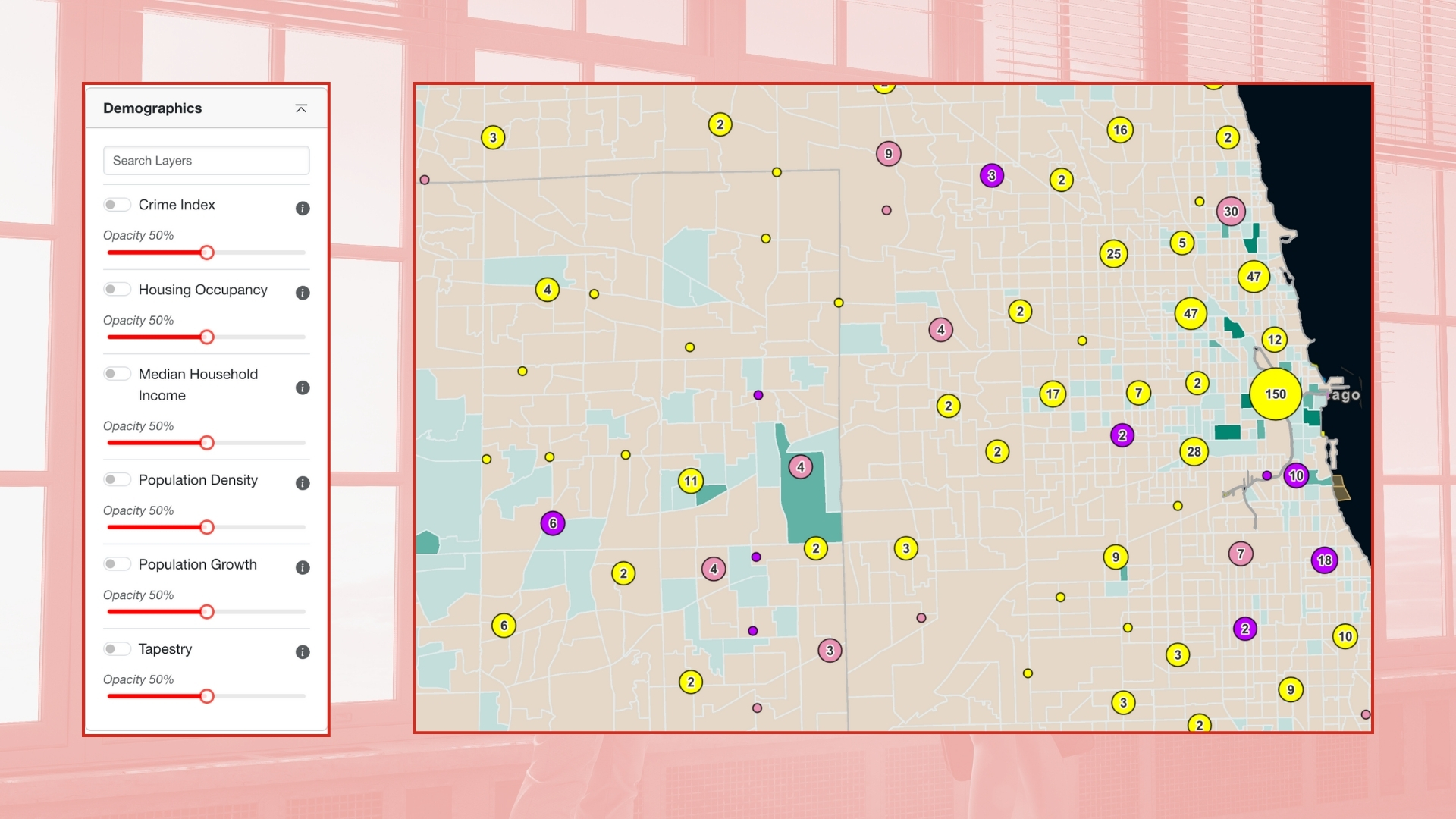
Area Demographics
Part of any project is figuring out whom it serves. We offer demographic data for any selected jurisdiction to inform your research.
PROJECT MAPPING
Map planned, under-construction, and existing developments. Filter with your parameters to assess pipelines and construction activity.
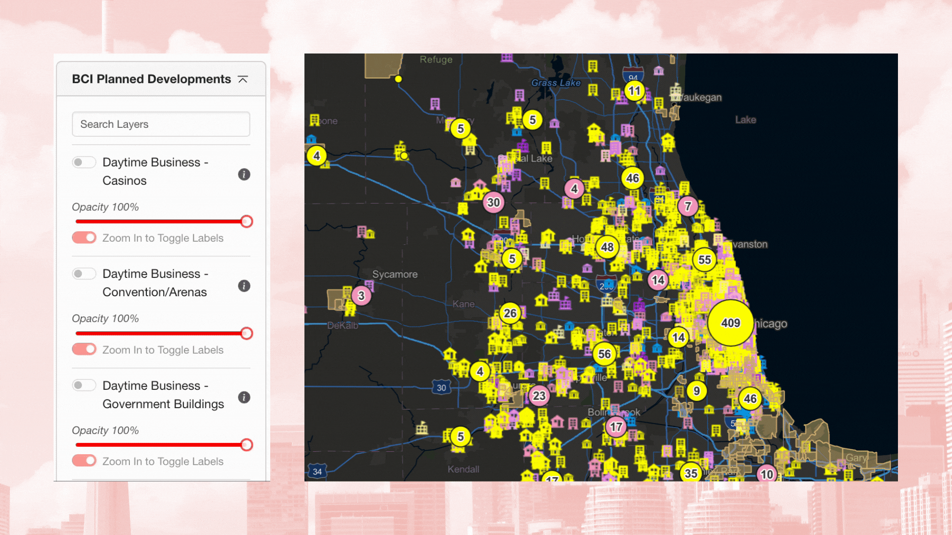
MAPPING LAYERS
Political and geographic mapping overlays allow you to keep your niche in mind while identifying the best opportunities.
DEMOGRAPHICS DATA
Any successful project serves a targeted audience, and U.S. Census data gives you crucial perspective on any locale.
CAN GEOSPEX™ HELP YOU?
Get started with a demo to see how Infrastructure+ works for you.